

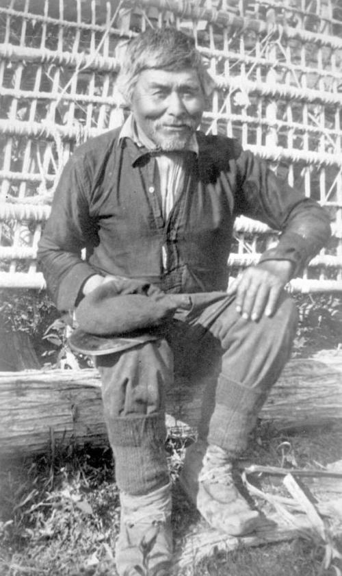
Side view of a 14 year old dog which was shorn each year for its hair. Source: Ian McTaggart-Cowan fonds, UVIC.
The Coast Salish “wool dog” is an interesting example of selective breeding of dogs for a useful trait, in this case, their long, fair hair which could be cut or plucked for weaving. Susan Crockford, in her comprehensive account of Wool Dogs (downloadable!) quotes Captain Vancouver:
The dogs belonging to this tribe of Indians were numerous, and much resembled those of Pomerania, though in general somewhat larger. They were all shorn as close to the skin as sheep are in England; and so compact were their fleeces, that large portions could be lifted up by a corner without causing any separation”
While Crockford writes that the wool dog was extinct as a separate breed by 1858 (it’s raison d’etre replaced by Hudson Bay blankets), it is still interesting to see a couple of pictures dating to ca. World War 2 showing two dogs on the Saanich Peninsula with strong echoes of the Spitz-genre wool dog phenotype – indeed, caption above explicitly notes this dog was “shorn each year.” (See also this poster (PDF) summarizing some wool dog research)


 The Archaeological Society of BC winter lecture series kicks off this Tuesday September 27th at the University of Victoria, with a talk by Dr.Pablo Restrepo-Gautier from UVIC’s Department of Hispanic and Italian Studies. Note that the talk is in a new room compared to last year: Cornett A129 – same building but on the south side. The text of the invite is below. The talk is free and open to the public. Prior to the meeting the ASBC will hold a short AGM.


