Tag Archives: Vancouver

Happy “Birthday”, Vancouver

Unidentified Musqueam Chief as portrayed by Cardero in 1792. Source: Vancouver Sun.

The City of Vancouver had its 125th anniversary yesterday, and the local press was full of reflective pieces on civic leaders, famous visitors, notable crimes and, of course, sports.  Well, it would be churlish not to wish Vancouver Happy Birthday!  Well done, Vancouverites.  But in all the coverage of this momentous event, I only see one single article which acknowledges that people might have lived at the mouth of the Fraser River for a tad longer than 125 years.  And a curious article (PDF)  it is: Ancient history of Vancouver’s first peoples: The city’s history predates its 1886 founding, with a native midden dating back 9,000 years

Continue reading

Two upcoming events in Vancouver and Victoria


1936 Field Trip by the Vancouver Natural History Society to Musqueam. Source: Vancouver Public Library. VPL Accession Number: 19483

In Vancouver this Sunday, September 19 at 1.00 there is a guided walk of the Ancient Salmon Stream and Musqueam Village, starting at Jericho Beach (details here) with Victor Guerin, “a cultural/linguistic consultant and historian, a member of the Musqueam First Nation and a speaker of the Musqueam dialect of the Central Coast Salish language Halkomelem. He has been learning about his people’s culture and history his entire life, including some 16 years of consultation and documentation with family elders and 4 years formal training in the Musqueam language with linguistic analysts at UBC.”

This talk/walk is one in a series from the False Creek Watershed Society, most of which look like they hold promise for an interesting conversation between historical ecology, traditional knowledge, and landscape development.  It would be good to see connections built or strengthened between restoration groups and archaeologists, who share many of the same values.  You can see the other talks and walks they sponsor here – two of them are actually today, Saturday September 18th.  OK, go to those as well!

The other upcoming event is the  Archaeology Society of B.C. monthly public lecture in Victoria, which is on Tuesday 21 September.  This month’s speaker is Grant Keddie from the Royal B.C. Museum.

Continue reading

Capilano University Field School Blog

"At each logging camp a familiar discovery was a wood burning stove or oven. The one pictured {above} had stumped some former students of Muckle's in the past because the student who helped recover the stove had read an engraving on the side saying "To Jake". After pondering upon this curious inscription, it was realized that the "J" had incorrectly been read, and the whole etching had actually said "To Bake", commonly found on ovens." Source: http://archaeologyfieldschool.blogspot.com/

I noticed that the Capilano University Archaeology Field School, which just started a few days ago near Vancouver, has a blog.  So far there are three days worth of entries and it looks like it will be a lot of fun to follow along with the students who, under the direction of  Bob Muckle, will be continuing to work on the archaeology of historic logging in the Seymour River Watershed, which flows into Burrard Inlet.  Much of the logging was conducted by Japanese immigrants, making for a nice overlay of ethnicity and capitalism and material culture.

Continue reading

More on the Sea-to-Sky Cultural Journey

Sign at the Horsehoe bay kiosk. Source: tad McIlwraith flickr.com account.

A month or two ago I commented on the Squamish and Lil’wat Cultural Journey website, which explores oral history and place names in the traditional territory of these two southwestern British Columbia First Nations.  I was really happy to see that Douglas College Anthropologist (and occasional commenter here) Dr. Tad McIlwraith has carried the review much further.  He’s even taken it into the field, so to speak, by documenting and discussing the actual cultural centre itself, and also the roadside kiosks which bring Squamish and Lil’wat histories to the travelling public.

Tad’s review has two parts.

Continue reading

Forthcoming Vancouver Archaeology Talks

Once in a while I yawn, stretch, and look across the Moat of Georgia and notice something interesting happening in Vancouver.  This time I see there are two forthcoming events for those within striking distance of the Velvet Rut.

First, UBC is holding its annual Archaeology Day this weekend, Sunday March 21st.  The program, which looks great, can be viewed here.  The event is free and open to the public and is held in the Anthropology and Sociology Building on the UBC Campus.

Second, the Vancouver Chapter of the Archaeological Society of BC is holding a public lecture featuring SFU professor Eldon Yellowhorn.  His topic is “Encountering Modernity: the Piikani Historical Archaeology Project.  The poster is below, click for a legible version.  The talk is Wednesday March 24th at 7.00 at the Museum of Vancouver (who don’t seem to have it listed on their calendar), and it is free and open to the public.

Memo to the ASBC-Vancouver: update your web site if you want people to come to your talks.

Click to enlarge

One more update on the Museum of Vancouver’s Petroglyph.

Interior Petroglyph now at Museum of Vancouver, while still in Stanley Park ca. 1980. Source: DanLeen.org

I have posted several times recently on a superb interior petroglyph boulder languishing in a shady courtyard at the Museum of Vancouver.  Together with Heather Pringle’s posts on this topic, we seem to have caught the attention of the Board of Directors of the Museum.

One of the Directors, Anthropology Professor Bruce Miller of UBC, called me the other day.  He consented to me posting notes from our conversation.   Continue reading

“Correct Map of the Gold Diggings”: May 20th, 1858

Detail of 1858 Map of Fraser Gold Diggings. Click for full image.

From UBC, this interesting 1858 San Francisco broadsheet “The Pictorial Newsletter of California” (large JPG file).  Most of the text is mundane births and deaths, but the map above from it is a lot of fun.  It’s especially interesting to see the “Cowitchin” Village at New Westminster.  Now, “Cowitchin” was often used as a generic term for many Coast Salish people in the early historic period.  But note too, just upriver at Fort Langley, a “Ninnimuch” Village, presumably Snuneymuxw First Nation, also known historically as the “Nanaimo” people, whose core territory would be on east Central Vancouver Island.  There are lots of reports of Vancouver Island nations paddling up and down past Fort Langley so its not that much of a surprise, but rather a nice testament to the extensive regional trade and, perhaps, permeable social networks in place across the greater Gulf of Georgia. It also makes me think the “Cowitchin Village” might indeed really be Cowichan. It’s notable the “Pinkslitsa River” (Harrison River) is the only lower tributary mapped, probably because it was an important route in and out of the middle Fraser, bypassing the canyon.  It’s a nice map, it’s early, and I’d never seen it before, so thanks to UBC and their Early BC Newspapers page.

Detail of 1858 map showing "Cowitchin" and "Ninnimuch" Villages on Lower Fraser.

From the UBC notes:  Pictorial News Letter of California: for the Steamer John L. Stephens San Francisco: Hutchings & Rosenfield; Charles F. Robbins, Printer, 1858

“Issued exactly one month after the first steamer left San Francisco headed for the Fraser (Bancroft p. 359), this appears to be the first separate publication relating to the Fraser River Gold Rush, and the first map published to illustrate the area for potential gold-seekers.”

You can also download a short PowerPoint file here, and there is an overview essay here.

Stanley Park’s Wandering Petroglyph

Petroglyph Boulder in Stanley Park. Source: Vancouver Public Library

I was intrigued by this 1930s photo of noted Vancouver photographer Philip Timms perched beside a large petroglyph in Stanley Park, not least because it is obviously not from the coast. The caption indicates as much: “rock was brought to Stanley Park from the Cariboo; at the former totem pole site at Lumberman’s Arch.”

A little digging around suggests this boulder was discovered in 1923 in the Lone Cabin Creek area of the middle Fraser River, just south of the Gang Ranch. It was moved to Stanley Park in 1926. As of 2002 at least, it was still there. If anyone knows for sure where it is, let me know.  The complete absence from flickr, for example, suggests to me that the information below sayng it is stashed out of site at the Vancouver Museum may be accurate.  This site has a number of undated pictures of it (not the apparent deterioration from the picture above – it probably doesn’t do well in the rain) and some history and interpretation which I can’t vouch for:

It is thought that this boulder may have been a marker of a Salmon site. Another theory has the stone important in puberty rites. This boulder is probably about 500 years old. This petroglyph was carved in the vicinity of Lone Cabin Creek, north of Lillooet, on the Fraser River. It first gained Euro-Canadian attention in 1923 upon its discovery by H.S. Brown a cariboo prospector. He brought its existance to the attention of William Shelly, the Vancouver Parks Board commissioner of the era. Shelly proposed moving the six-ton rock from its location on the Fraser to a new home in Stanley Park. Three years alter, the move commenced. The rock was first loaded onto a raft to be floated to the nearest railway station. This awkward plan failed as the weight of the boulder caused the raft to sink immediately after loading. The next, more successful attempt involved a team of ten horses and a sled. In the dead of winter, the “Shelly Stone” was dragged to the closest rail line. This whole procedure took over a month and cost Shelly two thousand dollars which was a lot of money at the time. The Shelly Stone arrived safely at Stanley Park. It was set in a foundation of concrete as it was felt this would prevent the enormous rock from being carried off or destroyed. The rock remained at Brockton Pt mislabeled as an Indian Pictograph until moved to the Vancouver Museum basement in June of 1992. During the years in Stanley Park, human contact and urban polution have worn on the petroglyph like sandpaper. It is hoped that the protected environment of the museum will guard its images from further deterioration. Since it is not part of the regular museum exhibition, it currently does not cost to view it.

This boulder must be of the highest spiritual and cultural significance — shouldn’t it be moved back to the Cariboo where it belongs?

Geist: Memory and the Valley Photo Essay

Sxwòyeqs (The Place that Everyone Died) | Stave Lake. Source: Geist Magazine.

A while ago I linked to a beautiful photo-essay from Geist Magazine on decaying towns on the BC coast.  I see they have another excellent photo essay, this one on the subject of the superposition of Euro-Canadian towns and spaces onto Aboriginal archaeological sites and significant places.  The text by Sandra Shields and David Campion is sensitive and evocative and the photographs are well taken — in some ways they are banal – an overpass, and access road – yet knowing what lies underneath triggers emotional reactions. UVIC’s own Duncan McLaren is featured as well so it must be a good article – Stave Lake (above) has two of the oldest archaeological sites in Canada (each more than 12,000 years old), parts of which miraculously survived the reservoir inundation.

The Geist authors are interviewed here, which is also well worth reading:

Interviewer: it’s not only peo­ple that are miss­ing in “Memory and the Valley”; you touch on the dis­ap­pear­ing salmon, the white pine, the waters drained away. There’s def­i­nitely that tone of loss through­out the whole work.

Campion: That is why we’re hav­ing the exhibit here in the old city hall in Chilliwack, with a wall of the orig­i­nal pio­neers look­ing down on the work. It’s because you strug­gle with these two nar­ra­tives. One says: When Canada started, we came to a land that had no peo­ple in it and we strug­gled really hard and made a won­der­ful life for our­selves and a future for our chil­dren. Whereas, for abo­rig­i­nal peo­ple, it’s a story of huge pain and suf­fer­ing, and a huge loss of peo­ple to dis­ease, even before con­tact. Then res­i­den­tial schools, cul­tural mod­i­fi­ca­tion, and so on.

So you’ve got this prob­lem at the base of Canadian soci­ety. For soci­ety as a whole to move for­ward, we need to find a way to acknowl­edge that loss, not just to have it mean some­thing in that on/off, negative/positive sense. As non-Natives, we need to find a way to absorb the real­i­ties of our com­ing here into our national narrative.

The notion of a “palimpsest” in archaeology is common, borrowed from manuscript studies: parchments would be scraped clean and re-used, yet, the older writing can still be seen and read, a ghostly precursor image.  Writing over writing, material culture over material culture, names over names and the living over the dead.  Every time you walk across the concrete apron in front of the MacPherson Library at UVIC you walk across an archaeological site.  Every time you leave the Elliot Lecture hall you walk across a site.  The Legislature is on a site, the Fraser Arms Hotel, the Willows Beach Tea House, all superimposed, a collective blotting.  Our feet tread the scraped parchment of the dead.

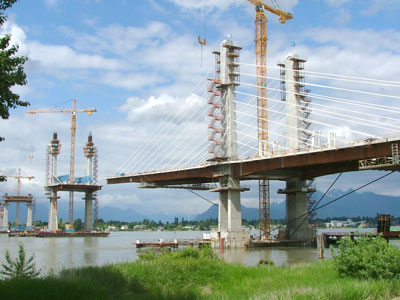
Leq’á:mél | Nicomen Island

Wapato, Camas, Tyee

4,000 year old Wapato tubers from archaeological site in Katzie territory.

The Tyee has a nice feature on invigoration of traditional use of Wapato (“Indian Potato”) and Camas.  I visited an open house at an archaeological site in Katzie territory a year or two ago and so here’s a couple of pictures of 4,000 year old Wapato tubers and a digging stick of presumably the same age which would have been used to help cultivate the wet beds.  At that site (almost completely destroyed by the new Golden Ears suburban commuter bridge), there were signs of the creation of enhanced “water gardens” for Wapato, and not just the harvesting of what occurs naturally.  Similarly, camas productivity was greatly enhanced by selective weeding and by the practice of tilling and selective bulb harvesting as well as deliberate burning to manage the camas fields.  All in all, exploitation of many plant foods (and shellfish) formed a practice intermediate between farming and gathering, and thereby are a powerful line of evidence for traditional use of large areas of SW British Columbia.  The Tyee article seems to me to be clear, accurate and informative.  I recommend it.

Tip of a wooden digging stick, ca. 4000 years old, Katzie territory. Two others of the dozens found can be seen in the background.