Category Archives: Technology

Weir on the River Koeye

Building Koeye Weir. Photo by Grant Callegari via indiegogo.

Building Koeye Weir. Photo by Grant Callegari via indiegogo.

There’s a pretty amazing new construction on the  on the Koeye River (pronounced roughly “kwaay”) on the central coast of B.C. (map).  A team has built a traditional style wooden-weir across the river, and are using it for fishery management – trapping, counting, measuring, and gently releasing salmon at the end (and start) of their life cycle. The construction has been documented at the willatlas.com blog, including some amazing photos, and there are posts on the Hakai Beach Institute blog as well. Even better, there is a short documentary.  This is actually is a teaser for a longer documentary, which is in the fund-raising stage, and I don’t mind using this blog as a platform to bring this really great project to people’s attention.  You can see their fundraising page here.

Continue reading

Final Qwu?gwes wet site report is available for download

Toy war club from Qwu?gwes site.  Source: Qwu?gwes Report.

Toy war club from Qwu?gwes site. Source: Qwu?gwes Report. Click to enlarge.

Dale Croes kindly sent me a link to the final report for the Qwu?gwes wet site (45TN240), which is  is located on Mud Bay at the southern end of Eld Inlet, Puget Sound, near Olympia, Washington (map). The site was apparently first occupied about 800 years ago.  This report, hosted at NewsWARP, checks in at almost 1,000 pages and about 80 megs, and is the product of more than 10 years of field-school and collaborative research with the Squaxin Tribe.  There look to be about two dozen authors. If you’re not up for the whole thing right away,  there’s a much shorter executive summary you can download here. But it’s a really impressive report covering everything from stone to bone to wood, bark, root, wood I.D., ethnobotany, paleo-seismology, fishtraps, and more.  It’s very clearly written at an accessible, non-technical  level, largely by students. I’ll pick out a few of many highlights below. Continue reading

Harpoon Arrows

Fishing at the Dalles, 1850, pencil drawing by George Catlin. Source: NYPL.

Fishing at the Dalles, 1850, pencil drawing by George Catlin. Source: NYPL.

I’m probably the last person to get the memo that you can fire a harpoon with a bow and arrow.  In fact,  I only just got my head around firing a harpoon with an atlatl.  Anyway, take a squint at the picture above – the figure in the lower left background is clearly shooting a harpoon-arrow from his bow.  The picture is from about 1850 and is a pencil drawing of a scene at The Dalles, on the Columbia River.  I’ll take a closer look at this picture below. Continue reading

Brainstorming beads

Shell beads from DjRw-14.  Note the interior diameters of less than one millimetre.  Picture courtesy of Terry Clark.  Click to enlarge.

Shell beads from DjRw-14. Large grid is one centimetre, small is one millimetre.  Note the interior diameters of less than one millimetre.   Picture courtesy of Dr. Terry Clark, CMC. Click to enlarge.

The previous post on the remarkable bead-rich burials in shíshálh territory generated a great discussion including contributions from some of the project leaders.  It’d be good to continue that discussion!  But one additional point, as Jesse Morin notes in those comments, and as one of the project leaders Terry Clark raised in an email to me, is the question of, quite simply, how are all these beads getting made?  As you can see in the picture above, these shell beads have a hole diameter of less than one millimetre.  Terry describes some of the holes being not much larger than a human hair!

Continue reading

Anchor Stones

Duwamish composite stone anchor. Source: UW.

Edit October 2018: Hoko Pictures are now here.

I was talking the other day about how under-represented organic technology is in archaeology generally, and especially on the Northwest Coast, where the old adage is that 95% of the technology was made out of plants (trees, wood, bark, roots, grasses, seaweeds).  A classic example of this phenomenon are anchor stones and sinker stones.  While some of these stones had grooves or perforated holes (and are thereby very visible and durable in the archaeological record), many may have been made by the more simple, subtle and expedient method of simply wrapping line or basketry around an unmodified rock.  When the organic component rots away, as it will most of the time, then the archaeologist has, well, an unmodified rock.

Anyway, it was a lucky stroke for my current interest that I came across the above photo from the University of Washington Digital Archives.

Continue reading

ASBC Victoria: Public Talk Tuesday Sept 20, Barkley Sound Archaeology

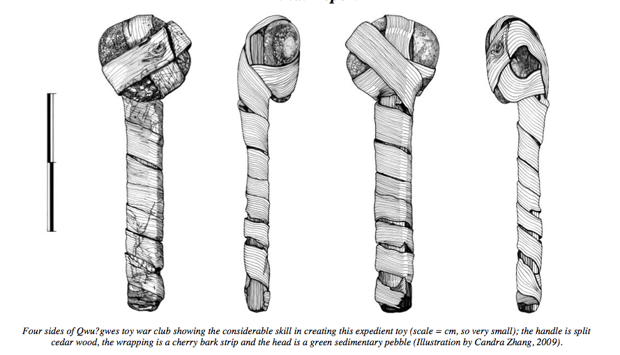
Kelsey, Rodney and Jinky in the older deposits at Hiikwis.

The local (Victoria) branch of the Archaeological Society of B.C. is firing up it’s winter lecture series.  The first talk is on Tuesday, and features UVic’s own Kelsey MacLean, speaking on the enigmatic stone tool assemblage from Hiikwis, in Barkley Sound.  Details below; it is free and open to the public.

Kelsey MacLean

M.A. Candidate, University of Victoria

Chipped Stone in Barkley Sound.

Abstract: In 2008, Hiikwis became the first archaeological site in Barkley Sound with a significant sample of chipped stone materials. This material provides new insights into the culture history of Barkley Sound and the Nuu-chah-nulth peoples. It is well known that settlement patterns changed drastically in Barkley Sound from approximately 1500 to 1000 AD (Marshall 1993:40), which is a period of occupation represented at Hiikwis. Although the population movements both before and during this time have been theorized about before, Hiikwis is causing researchers to reconsider their previous assertions. Analysis of the chipped stone materials aims to determine who created these stone tools, and why there is a relative abundance of these tools at this site in contrast to the surrounding excavated locations. Essentially, why are there chipped stone tools here, but not next door?

Bio: Kelsey MacLean is currently an MA candidate at the University of Victoria. She is an executive member of the Victoria Branch of the Archaeological Society of BC and has a BA in Anthropology and Sociology from the University of Victoria. Her first fieldwork experience was in Barkley Sound in 2008 and she has returned each summer for further research. Her interest in the Tseshaht and the Barkley Sound region led to her pursuing her MA thesis project within this extended archaeological project.

SEP. 20, 2011, 7:30
pm Pacific Forestry Centre,
506 West Burnside Road.

Map

More on Puget Sound Clovis

From near Seattle, the Yukon Harbor Clovis Point. Source: LeTourneau 2010

Some time ago, I made a post illustrating that Clovis projectile points are known from a number of undated contexts in Puget Sound.  Most of these are surface finds, though a couple were buried in or under wetland deposits.  These were largely under the archaeological radar until Croes et al. briefly summarized the data within a book chapter on Puget Sound Projectile Points.  One of the wetland finds was from Yukon Harbor on the Kitsap Peninsula, across Puget Sound from Seattle, of which I previously posted a low-quality photo.  A short article describing this artifact has recently been published in the journal Current Research in the Pleistocene, and the author, Phil LeTourneau of Seattle’s Burke Museum, was kind enough to send me a copy.

Continue reading

Bridge River Housepit Geophysics

Magnetometry map of the Bridge River Site housepits. Source: Prentiss et al. 2009

Wouldn’t it be nice to be able to see what was underground without having to go through the time-consuming, expensive and destructive process of digging it up?  There are some nice geophysics techniques in archaeology for doing just that, though none are yet a substitute for excavation.  I noticed the other day (and you were quizzed on it) that there is a very comprehensive recent report online (45 meg PDF) by Anna Marie Prentiss and colleagues, on work at the middle Fraser pithouse village of Bridge River (EeRl-4).  This village lies in the territory of Bridge River Band (Xwisten) and the St’át’imc Nation.  While there is a huge amount of archaeological interest across the 350 page report as a whole, it was the use of geophysics on an interior pithouse village which got my attention.

Continue reading

NW Geology Field Trips Lead to Chert?

The Aldergrove Glacial Erratic. source: geocaching.com

This is something a little different, leading to something cool: the NW Geology Blog has assembled quite a few self-guided geological fieldtrips, mostly in the Seattle to Vancouver corridor.  There are two in the Fraser Valley: the Aldergrove glacial erratic, and the Shasta erratic in Coquitlam.  The other BC field trip is to the recent, massive debris flow at Capricorn Creek.

But it was one of the Washington State trips which caught my eye though: a trip to a formation of Stilpnomelane at Blanchard Mountain, Skagit County, near Bellingham Washington.  The reason this caught my eye: the formation is intersected by massive, green chert beds.

Continue reading

Elfshot goes “ground stone”

Ground slate ulu blades in progress. Source: Tim Rast, Elfshot.

I’ve mentioned before the terrific Back East archaeology blog Elfshot, in which Tim Rast documents his journey of “making a living as a 21st century flintknapper”.  Flintknapping is all well and good, of course, but the real magic lies with ground stone, which for many years has been marginalized in archaeology as being, well, obvious and uninteresting.  I think one paper I read digresses with an anecdote about the author’s toddler son independently inventing the technology!   If it is so obvious, though, then why is it only selectively implemented by people in certain environments, at certain times, to certain degrees of intensity?

Continue reading