

Danny at the helm, aaaargh Billy.
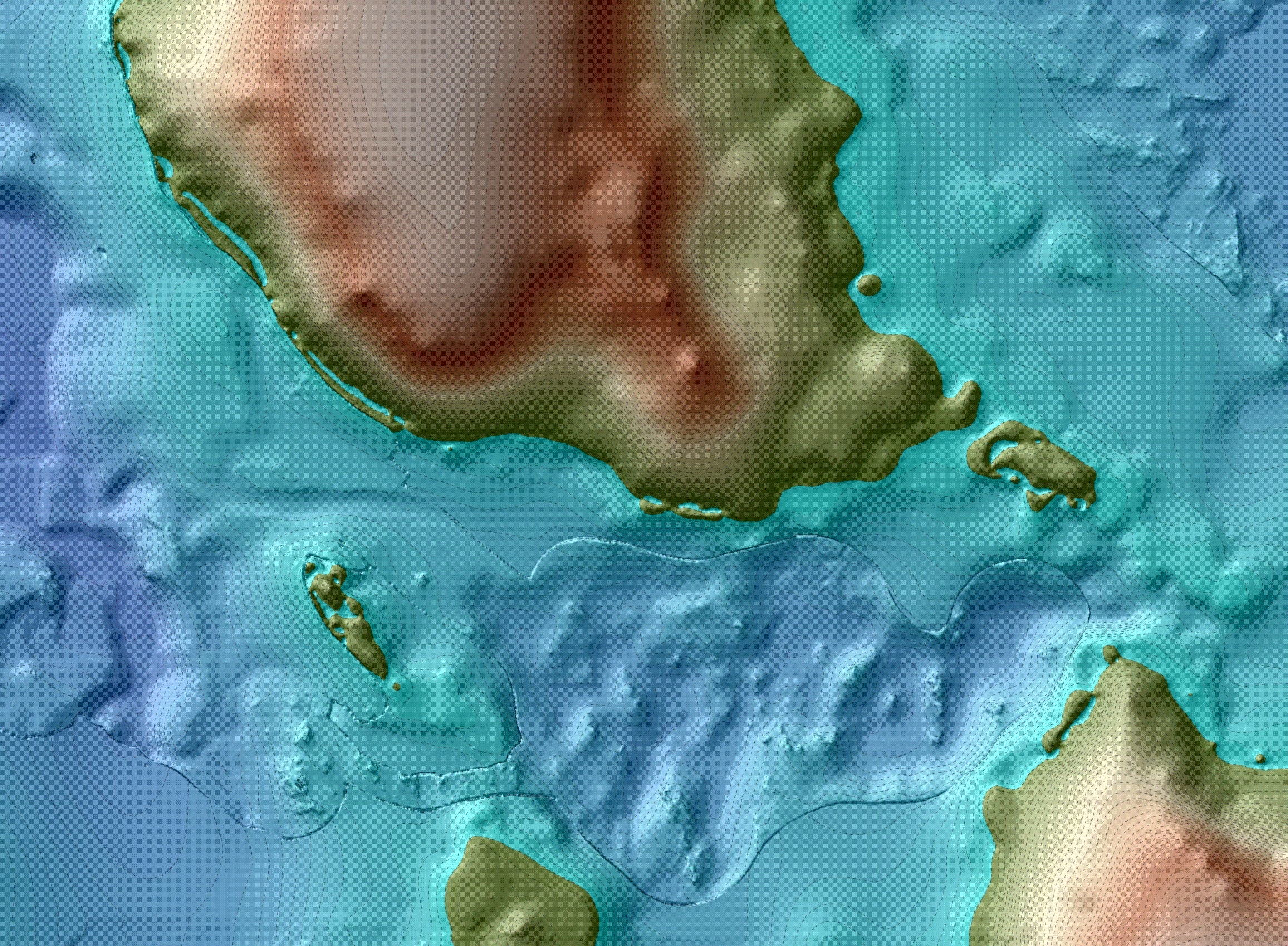
Underwater research at Section Cove, near Gaadu Din. I posted a picture earlier of a diver on the bottom. Here is a view from topside — Danny, boat skipper, wise-ass and all round rock solid good guy — has a GPS-linked laptop in front of him which is displaying the bathymetry of Section Cove. (see the image on Danny’s screen here, courtesy of Daryl). This enables him to tow the sonar fish exactly where required, or, on this occasion, help position a small dredging bucket for bottom sampling purposes. With differential GPS, you can position the ship to within less than a metre of where you want it, relative to the bottom. This means measuring the distance between the GPS antenna and the crane and building in an offset, which is trickier than it sounds. The bathymetry is also sub-metre in resolution. Thus, we can target the bucket exactly where we want it — of course strong currents and bucket flutter can still move it around some. It has been slow progress on this work but all the pieces are in place for what could be an exciting breakthrough – a base camp on a small lake, now drowned, dating to sometime older than 11,500 solar years ago would be most welcome considering most of our other sites of this age are rather one-dimensional.
The purpose of the camp could be base camp for bear hunting in the nearby Gaadu Din caves, or more likely sockeye fishing in the lake-stream system that used to flow along the terrain here, under Danny’s keel.

The lake, the salmon, the cave, the creek. Green tones are now underwater. Image prepared by Daryl.

