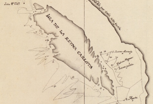
Dixon’s 1787 map showing Haida Gwaii as an Island. Source: Library of Congress
Old Maps are Cool. Enough said. Or maybe not quite enough. Continue reading

Dixon’s 1787 map showing Haida Gwaii as an Island. Source: Library of Congress
Old Maps are Cool. Enough said. Or maybe not quite enough. Continue reading
Posted in archives, First Nations, Haida Gwaii, history, Northwest Coast
Tagged Captain Dixon, cartography, charts, Haida Gwaii, Haida Nation, maps

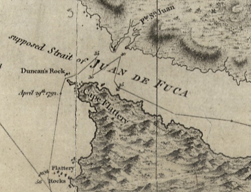
Detail of Capt. Vancouver's 1792 chart showing the "supposed strait of Juan de Fuca". Source: viHistory
vihistory is a web site designed to aid in historical research of Vancouver Island, at which it succeeds admirably. You should poke around and have fun with their census data and the other worthy, if dreary, pursuits it affords the serious scholar.
One feature which is not immediately clear on first glance, perhaps deliberately as has entertainment potential, is a large selection of very high-resolution maps and images which you can download from this page. The file sizes are large, of course, but increasingly that is less of an obstacle in the past. The maps are mostly of historic Victoria, but there are some regional maps such as telegraph and lighthouse maps of British Columbia, and a couple of maps of Nanaimo. As usual, I have surfed through the maps so you don’t have to – and some of them are remarkably fun, and informative.
Google is putting together a workshop together with the Indigenous Mapping Network:
On February 25th and 26th, 2010, Google and IMN will host a workshop on the Google campus for members and staff of indigenous groups who want to learn about Google geospatial and mobile technologies. This hands-on workshop will approach Google technologies with the special concerns of indigenous communities in mind, and will focus on the technical aspects of using Google Earth, Google Maps, Sketchup, Android mobile phones and Open Data Kit, among other technologies.
I’m pretty sure both parties are on it, but despite Google’s corporate motto of “Do No Evil” uploading sensitive, spatially-referenced cultural information to their servers seems like something that would need some thought. Nonetheless, it is interesting to see this as a pro-active direction Google is taking. Canadian First Nations are some of the most GIS-savvy anywhere in the world. One of their main networks seems to be the Aboriginal Mapping Network, who have an excellent-looking book coming out soon called Living Proof: The Essential Data-Collection Guide for Indigenous Use-and-Occupancy Map Surveys by Terry N. Tobias. Also see their handy link to data sources especially for BC.
Posted in anthropology, Cultural Resource Management, First Nations, Miscellaneous
Tagged cartography, First Nations, google, maps, Nisga'a