
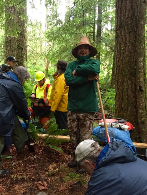
Louie Wilson commanding the shovel bums on Quadra Island. Source: qmackie
There’s a cool new video just released about research in the Discovery Islands, mainly Quadra Island, on the central east coast of Vancouver Island (map). The video was produced through the Hakai Institute, a philanthropic organization which over the past decade or so has been funding a lot of primary research in ecology, geology, culture and archaeology on the B.C. Coast. The archaeological project in the video was focused on the terminal Pleistocene and earliest Holocene, with an effort to document long-term sea level history for Quadra Island, and then use LiDAR-derived base maps to help with predictive modelling and other tools to find old sites on old coastal landforms. That was the plan! I mean, of course the real plan was that grad students would do as much of the brainwork as possible, Daryl would dig, and high-quality coffee would be made.
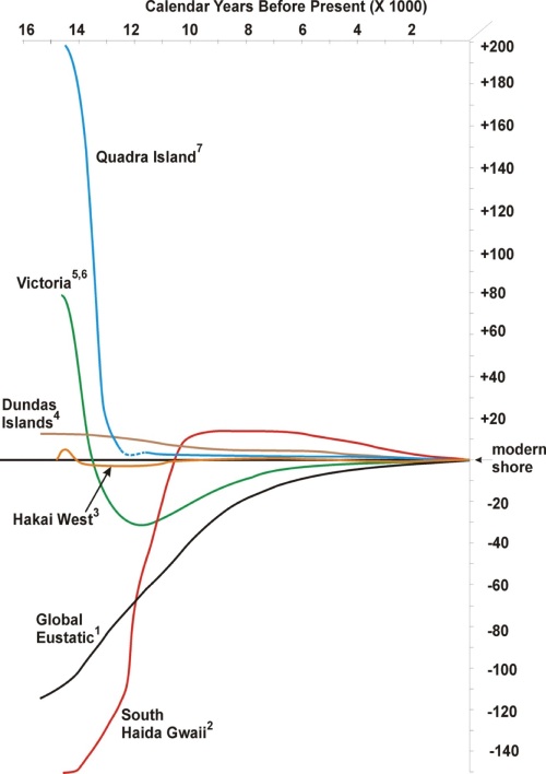
BC sea levels relative to modern, 15,000 years ago to present. Source: Fedje et al 2018.
It actually worked out pretty well. Sea levels are extremely local on the NW Coast – the above image shows that at the same time as the sea level was 200 metres higher than modern on Quadra it was 150 metres lower than modern on Haida Gwaii. The source is an open access paper here; if you find it sort of confusing then Daryl Fedje does a good job explaining it, with an animation, here.

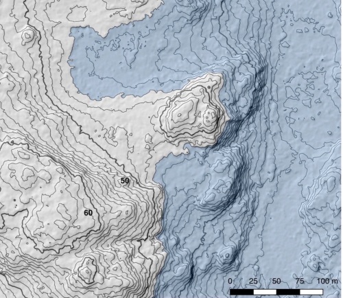
Hillshaded Lidar bare-earth model (grey) vs 1:20,000 model (green) for central Quadra. Source: Lausanne/Vogelaar.
LiDAR can produce elevation models and contours at less than one metre vertical resolution, and it is also possible to digitally remove the trees. The resultant “bare earth model” gives an extremely fine (if somewhat artificial, moonscape) image of the terrain and many features not really discernible from the ground can be seen.

Quadra Island when sea levels are at 160 metres above modern ca. 13500 years ago to 10 metres above modern ca 12,500 years ago. Image by Keith Holmes, Hakai Institute.
With sea levels higher than modern and dropping fast, a small archipelago fused together into the large island which is now Quadra. Former shore lines are now stranded high in the forest. There is a Hakai Blog post here which gives more detail on this process of landform visualization and “virtual flooding”.
Paleo-tombolo at +48 metres above modern sea level. Blue areas were salt water, grey were dry land when site on this tombolo was occupied. Note one-metre contours on hill-shaded LiDAR derived base model. Source: Colton Vogelaar thesis.
Some of these, such as tombolos, have very high archaeological potential and the project successfully found sites on some of these (thanks largely to work by UVIC grad students Alex Lausanne and Colton Vogelaar).

Alex, and the very top of Daryl’s head, recording strat at a site on a stranded marine shoreline, Quadra Island.
With high potential site locations identified, then digging could proceed. In many instances, excavation went into paleo-coastal deposits, and waterworn stone tools were found, or stone tools embedded in paleo-estuarine deposits. This part of the project isn’t really nailed down fully yet since it turns out to be a tricky dating context, but there are indeed many archaeological sites on stranded marine terraces of various elevations.
So the video gives a good sense of the project, this post is just for a little added context.
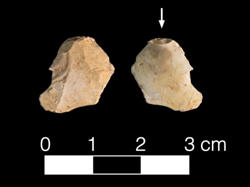
Bifacial reduction flake from a raised marine terrace on Quadra Island. Photo: Colton Vogelaar.
Oh yeah, and the crew learned, never touch the Penguin mug.
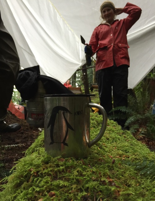
Hands off The Penguin Mug!


That video is very nicely done. Great photography too and love the bird.
LikeLike
Pingback: Tansy Inspects Raised Beaches | Quimper Hittys
Falls in line with the paleoshoreline work that Gary Wessen and David Huelsbeck did at Makah!
LikeLike
Hi JustAGirl, yes they have done some great work! We discussed some of it a long time ago here, the Waatch River site….
Do you know what else might have been done since then?
LikeLike
Hi everyone! Why had I not seen this NWC blog before now! I am still around in local (mostly early period) archaeology, particularly on Vancouver Island, with an eye up and down the Pacific coast. Stay tuned for more from me… Sorry not to have posted my continued presence in the region any earlier!
Martina
LikeLike
This was a very fascinating article to read, having lived in BC all my life. I applaud you for your research!
LikeLike